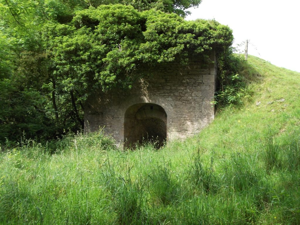
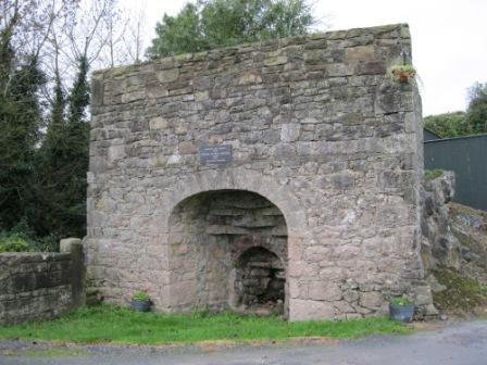
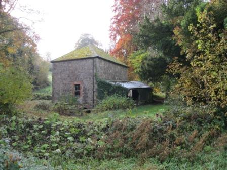
Lime Kilns were a regular feature in Meath Fields and give their name to many fields all around the County. In some fields there are ruins of the old lime kilns to be seen while in many others, the field name and people’s memories are the only indications remaining of the former activity in the field. Lime kilns burned stones to make lime for use in farming and also to create quicklime to be used as mortars and stabilisers in traditional buildings. For the workers at a limekiln it was a hard and dirty job. The survey has yielded up to 200 field names ‘Lime Kiln’ or ‘Kill Field’.
Limekiln at Moore’s Field, Keenaghan, Kilmainhamwood (photo by John Corbally)Photo of limekiln at Boltown near Kilskyre (photo by Sean Smyth)Restored Limekiln at Nobber (photo by Joan Mullen)
Brick fields
There are almost 100 fields identified in the survey that are either called names like ‘The Brick Field’, ‘The Brick Yard’, ‘Brick Hill’ or ‘The Brick Meadow’ or where there is some reference to brick making or brick clay extraction in the past.
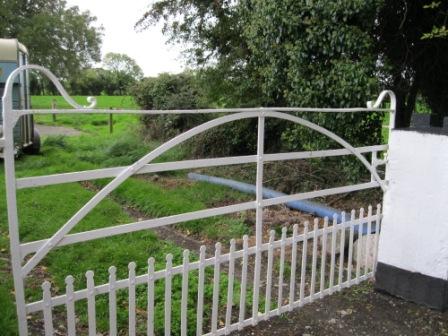
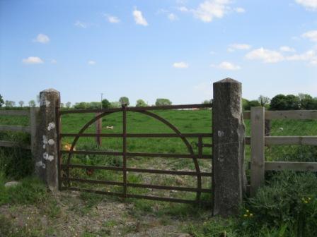
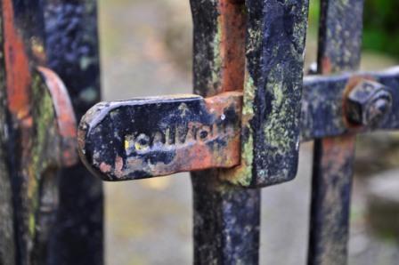
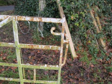
Lots of examples of fields with ‘Forge made riveted iron gates’ have been highlighted. Some local historians can identify the forge where the gate was made by the style of the gate. These gates are in decline, usually they are just too narrow for modern machinery. Many that do still exist are somewhat the worst for wear. Much information has also been found about old forges, blacksmiths and foundries all around Meath. Although many ceased to operate more then 50 years ago, their impact on the rural community is still apparent in the field names and lore of county Meath.
Forge made gate at Redmountain, Donore (photo by Joan Mullen)Forge made gate at The Reask, Painstown, Beauparc (photo by Joan Mullen)Forge made gate and cut stone pier near Kilskyre (photo by Joan Mullen)Forge made gate, cut stone piers and stone walls at entrance to field near Nobber (Photo by Joan Mullen)Forge made gate and cut stone piers near Staholmog (photo by Joan Mullen)Forge made gates at entrance to thatched house and farmyard at Gormanstown, near Stamullin. Here there are two gates, a narrow gate for pedestrians and a wider gate for other traffic, also traditional whitewashed walls. (photo by Joan Mullen)Blacksmith’s marking with the inscription ‘Callaghan’ on latch of forge made gates at Martry Graveyard. These gates were made by Henry Callaghan, a blacksmith at Connell’s Forge Ongenstown, Bohermeen. These gates were yard gates in Martry and were rehung on the extension to Martry Graveyard in recent years. Many blacksmiths branded their work in some way. (photo by Eleanor Tallon)Michael Casey at the entrance to Casey’s Forge, Nobber. This continues to be a working forge (photo by Joan Mullen)
Traditional trades
The abundance of specialist jobs that people worked at on farms and in rural areas in the past is also highlighted in field names and their descriptions. There is mention of people who worked as Cattle Drovers, Herds, Ploughmen, Harness Makers, Nailers, Thatchers, Threshers, Blacksmiths and Tailors. Most of these specialist occupations have declined and some no longer exist.
Thatched cottage and outbuildings near Horistown, RathkennySteam threshing underway at Moynalty Steam Threshing Festival (photo courtesy of Moynalty Steam Threshing Festival)
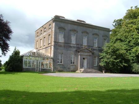
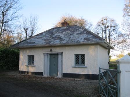
The landed estate was the central feature of Meath’s rural landscape in years gone by. Even today around the county much evidence of Meath’s estates is still clearly visible, such as the beautiful trees inside the estate walls, gate lodges, large entrances, big houses and so much more. Of course the fields that are or were part of landed estates also produce a wealth of other historical information with features such as Ice Houses, Old Windmills, Walled Gardens, Pigeon Houses, Mausoleums, Herd’s Houses, Orchards, Deerparks, hydraulic rams, courtyards, boat houses and many more.
Old boat house at Ardmulchan House between Stackallen Bridge and Navan along the River Boyne (photo by Joan Mullen)Walled garden in south Meath near the Dublin border. This garden now has an arboretum, boxwood and grass (photo by Joan Mullen)
About 13 fields were identified with the special ‘Ha Ha’ feature. A ‘Ha Ha’ is a special wall usually built in the 17th and 18th Century on country estates. They are usually located a distance in front of the main house. Ha-ha walls typically formed a boundary between the estate’s gardens and grounds. These walls were constructed so as to be invisible from the house, ensuring a clear view across the estate. Ha-ha walls consist of a sunken stone wall, its top level with the garden, with a deep ditch on the far side: an effective barrier to livestock.
Restored and rebuilt Ha Ha wall at Teltown, Donaghpatrick (photo supplied by the Conservation Office at Meath County Council)Hamwood House near Dunboyne (photo supplied by the Conservation Office at Meath County Council)Dowth Hall (photo supplied by the Conservation Office at Meath County Council)Gate lodge at entrance to Rathkenny House (photo by Joan Mullen)‘The Big House’ and surrounding landscape – Hilltown House, Bellewstown viewed from the hill of Bellewstown (photo by Grace McCullen)
The vast subject of holy wells in Meath fields, associated cures and other rural traditional cures could fill an entire book in itself. This whole area is closely interwoven with people’s religious beliefs and also with folk belief and traditions.
There was a specific ‘tickbox’ on the field survey form for a ‘Holy Well’ and space was allocated to give extra information about the well’s patron, cures and pattern days. Just over 60 holy wells were identified in this way. However, we were given information about many other wells with cures where the surveyor did not specifically tick the box to confirm it is a ‘Holy Well’.
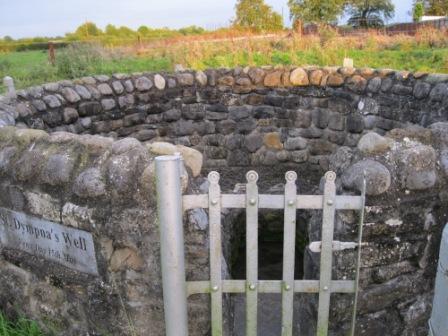
Many of the wells are linked with a patron saint, including some well known saints such as St. Patrick, St. Anne, St. Brigid, St Finian, St. John, St. Colmcille, St. Fiach, St. Dympna, St. Seachnaill and St. Joseph. There are also several less well known saints associated with the wells such as St. Gorman, St. Toole, St. Oran, St. Benignus, St. Scíre and St. Rodaigh. Many other wells may originally have had a patron saint but that information has been lost.
Some holy wells are just known as being holy, while others have specific cures related to them. Some of the more frequently mentioned cures are for warts, headaches, toothaches, sore eyes and sick stomachs.
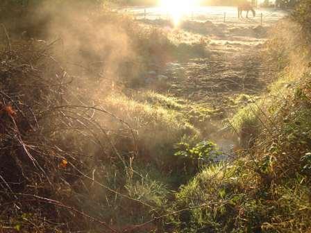
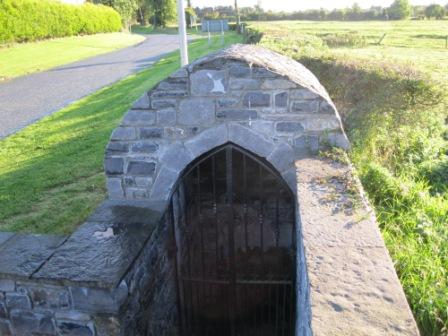
St. Finian’s Holy Well, Clonard with shelter (photo by Joan Mullen)St. Dympna’s Holy Well in a field at Kildalkey. The feast day is celebrated on 15th May (photo by Joan Mullen)St. Gorman’s Spring at Ballynakill, Enfield with steam rising on a frosty morning. St. Gorman’s Well is a Holy well. It is also a hot well; during winter months the water at this well is quite warm. Steam can be seen rising over it in frost & snow (photo courtesy of the Heritage Office at Meath County Council from ‘The Making of Meath’ by Robert Meehan) St. Scíre’s Holy Well outside Kilskyre Village (photo by Joan Mullen)
‘Tobar’ is the Irish for well and many holy wells have a name like Tobar or sometimes spelled Tubber. Of course wells called Tobar are not necessarily holy wells. It is likely that fields called ‘Tobar Ultan’ (Toberultan, Balrath, Kells) and ‘The Meadow of Tobar Anthony’ (Spiddal, Nobber) did have holy wells. Unfortunately, in some cases the full details of a holy well have been lost.
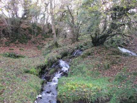
Waterfall at the Blessed well at Shancor and Corcarra, Kilmainhamwood. The waterfall is known as ‘St. Patrick’s Cascade’ on old maps. This well is also sometimes known as ‘Tobar Alt an Easa’ (photo by Joan Mullen).
The Meath Field Names Survey form specifically asked people to tick a box if they knew there was either a Mass Pass or a Mass Rock in the field.
In the findings about 20 Mass rocks are noted and over 200 fields are identified that had a Mass pass or path. In some cases the surveyor went to the trouble of drawing in the exact route of the Mass pass on the townland map they were working on. These paper maps will be archived with all the original survey sheets at the Local Studies department in Meath County Library. It can be seen that many fields with Mass Paths also have stone stiles.
Mass Rock at Glack near Ballivor (photo by Michael Gunn)Stone stile on Mass Path at Rushwee near Slane (photo by Joan Mullen)
There are about 13 references to Hedge Schools in the data collected through the project. Given that these Hedge Schools were so temporary in nature, it is truly amazing that so many details about them have been carried through in field lore until the present day, including the ‘Masters’ names in many cases and, in a some cases, even the fees paid by the students.
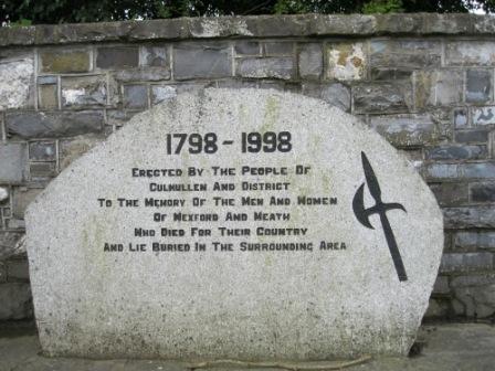
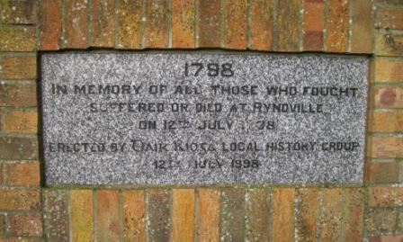
1798, Croppy Graves and Memorials
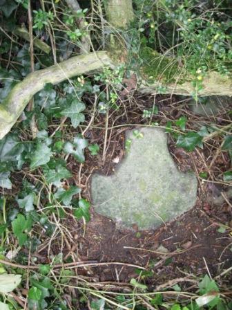
In 1798 many Wexford men died on expedition to Meath. Most of them were buried where they fell; some were only covered in shallow graves by local people. Many of the graves were marked with large stones, some of these memorials also took the form of crosses. In some cases more recent memorials have been erected on or close to Croppy graves. Often these memorials are located on the roadside adjacent to the fields where the Croppy graves are. Many of the newer memorials were erected in 1998 on the 200th Anniversary. The areas and townlands where 1798 activity and Croppy graves are referred to in the Meath Field Names Survey tie in well with the route of the Wexford Army as shown on a map in Eamon Doyle’s book, March into Meath: In the Footsteps of 1798.[1] The information regarding Ongenstown, Killallon, Moynalty and other areas west of Navan is not noted by Doyle in his publication.
1798 Memorial in Culmullen village erected in 1998 (photo by Joan Mullen)It is thought that this small stone cross along the road at Whitewood Nobber is a Croppy memorial. There are at least three of these stones close together in the same area along the road near McDermott’s old pub (photo by Joan Mullen)White iron cross on the roadside in Rathkenny just beside the townland boundary with Horistown as a Croppy Grave memorial (photo by Joan Mullen)Croppy memorial erected for the 200th anniversary in 1998 at Ryndville near Enfield (photo by Joan Mullen)Plaque on Connell’s Forge Ongenstown, Bohermeen commemorating this forge’s link to the 1798 Rebellion (photo by Joan Mullen)
Famine memories in Meath Fields
The Famine has firmly left an imprint on the landscape of Meath and on the people who inhabit it. There are almost 100 separate references to the Famine in fields surveyed through the Project. There are many mentions of Famine ridges, somethimes also known as lazy beds.
Famine ridges, also sometimes known as lazy beds, in field at Loughcrew, Oldcastle near Cairn T carpark (photo by Seamus Smith)
The impact of the Famine Relief work around the county is still very much in evidence. The work of road building, wall building, river straightening and even possibly the construction of a man made fox covert are all mentioned. It is poignant that several roads in the county that were built as famine relief work are still known as the ‘New Line’ today, over 150 years later.
The remains of famine villages are noted in several fields. In some cases the house outlines and other features are still clearly visible. It is amazing that they have lasted untouched for so long with all the modern farming practices. Sadly, there are also many mentions of burial places in Meath fields from famine times.
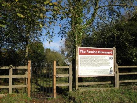
There are also a few references to the Workhouse at Dunshaughlin and the Alms House at Kildalkey both closely linked to the Great Famine in Meath.
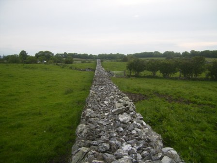
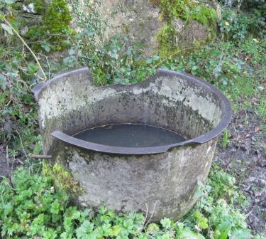
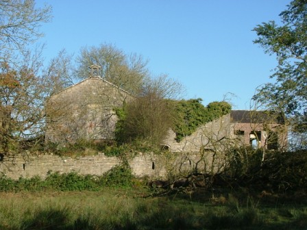
The Famine Graveyard located at the rear of the old workhouse at Dunshaughlin (photo by Joan Mullen)Stone wall at Boolies, Oldcastle photographed from the top of the wall. This wall was built as Famine Relief work. The straightness, length and quality of the work can be clearly seen. ‘The large stone walls measure about 6 ft / 2 metres high, approximately 4ft / 1.25 metres wide and over 1 mile / 1.5 km long. These stone walls were built around 1850 (during the Famine) to give employment and clear the land. Hugh “the Bow” Reilly started the project paying each person 1d per day, working from dawn to dusk. He ended up broke having taken on such a big project.’ (photo by David Sheridan).Iron cauldron in old farmyard near Rathkenny. These iron cauldrons are still to be found in fields and farmyards all around the County. Some of them may date from famine times (photo by Joan Mullen)Building at Durhamstown, Bohermeen dating from Famine times. It is thought that this may have been an overflow building for the workhouse in Navan. It thought that there are burial sites close to this building (photo by Stephen Ball)
[1] Eamon Doyle, March into Meath: In the Footsteps of 1798, (Dublin, 2011), p. 53
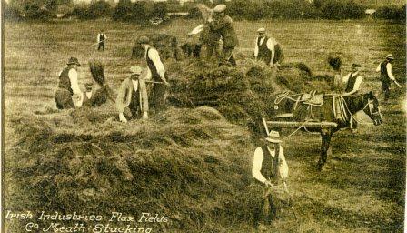
An unexpected finding of the survey has been the quite frequent references to Flax growing in Meath in times gone by. This is sometimes revealed in the field name – names such as ‘Flax Field’, The Bleach, The Blaych etc. Extra information is often given in the notes about the history of the field with mentions of flax ponds, holding ponds, flax pits & drains, bleaching, bleaching greens, retting, soaking & steeping of flax, flax mills and flax advisors. Some of the flax was grown during the war and some prior to that.
Historic photo of Flax stacking in County Meath. The caption on the photo reads ‘Irish Industries – Flax fields, Co. Meath, stacking’ (photo courtesy of ‘Staidéar Áitiúil – Seirbhís Leabharlainne Chomhairle Chontae An Mí / Local Studies – Meath County Council Library Service’)
Tobacco
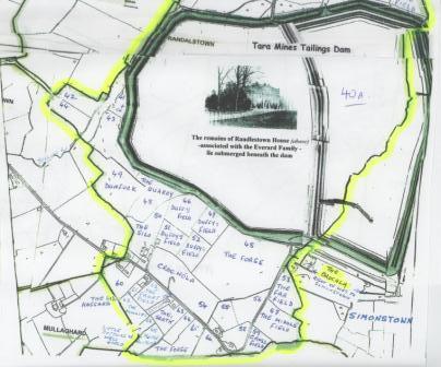
Tobacco growing also gets several mentions in field names and notes around the County. It is usually linked to Randalstown Estate near Navan. Tobacco drying sheds have been mentioned in fields in several areas.
Map of Randalstown townland showing the part of the townland where Randalstown House was. Today the remains of Randalstown House and grounds, once associated with the Everard family and the tobacco industry, lie submerged beneath the Tara Mines Tailings Pond. This dam or pond covers a large part of Randalstown townland and most of what was once the thriving Randalstown Estate (image supplied by Ethna Cantwell)
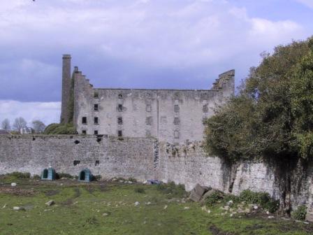
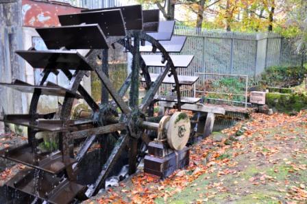
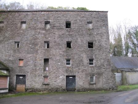
Mills were very important both socially and economically in local areas in the past and they have clearly left their mark on Meath’s landscape and fields. There are over 200 references to mills in the Meath Field Names Survey. A great deal of information on Meath mills is also available in the Meath Industrial Heritage Survey[1] and in William Hogg’s book publication[2].
The Meath Field Names Survey has identified about 90 fields with ‘Mill’ mentioned in the actual field name. In all, there are over 200 references to mills in fields surveyed. As well as fields with names such as ‘The Mill Field’, ‘Millers Field’, ‘Mill Hill Yard’, or ‘Mill Road Field’ much information about features including mill races, mill weirs, mill ponds and mill stones is also given.
We are told about water mills that were along many of Meath’s rivers including the Boyne, Blackwater, Inny, Skane, Delvin, Nanny, Dee, Tolka, Mattock and Causey rivers. Most mills were corn mills although we also have mentions of saw mills, flax mills, linen mills and woollen mills.
For many of the mills mentioned, they were named after the family who owned and managed the mill or who leased it from the local landlord.
Newhaggard Mill at Trim (photo supplied by the Conservation Office at Meath County Council)A close up view of the working mill wheel at Martry Mill.For several generations now this mill is in possession of the Tallon family. It is a fully operational corn mill and one of the very few in Ireland which continues to manufacture stone ground wheaten meal for baking (photo by Frances Tallon)Old watermill at Clowanstown, Killeen, Dunshaughlin. The old miller’s house is just beside the Mill (photo by Joan Mullen)
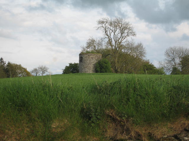
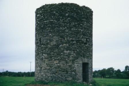
Windmills
In thinking about Meath fields and common features, windmills are certainly not a feature that spring to mind. The Field Survey has mention of 10-12 windmill sites in fields around the county. In some cases the field name is the immediate tell tale sign with a name like ‘Windmill’ ‘Windmill Field’ or ‘Windmill Hill’. In other cases the field has a different name entirely but we are told about the remains of the old windmill. Many of these windmills worked to supplement the nearby watermill.
Ruins of a windmill in a field at Headfort, Kells (photo by Eamonn Courtney)Ruins of windmill at Bartramstown, near Ardcath. “The tower windmill in Bartramstown was built in 1837 and contained all the milling machinery in the domed top to which the sails were attached. This was the only part that revolved. The sails were made of canvas or sailcloth, laced over wooden latticework and arranged so that they could be unfurled.”(photo by James Gargan, courtesy of Frances Lee Gargan from ‘The Parish of Ardcath Clonalvy: A History’, 2012).
[1] Antoine Giacometti & Steve McGlade, Meath Industrial Heritage Survey, (Meath County Council, 2010)
[2] Willam E. Hogg, The Millers and the Mills of Ireland – a database list (1700-1900), (Dublin 2010)
Many, many field names are associated with people. In some cases the people are current owners, very often they are former owners and, in other cases, the field name can link to people who worked the fields or lived adjacent to the field. Field names can originate from first names and surnames or family names. In many cases the person after whom the field is called is long gone and the family name may not even be in the area any more.
A field named after a former owner keeps their link with the area and attributes a certain amount of respect to the former owner or worker. Nicknames were very commonly used in years gone by. Sometimes they were used to differentiate between people of the same name in communities where some family names were very common. Many fields called after people use the person’s nickname.
Genealogy
It is hoped that the Meath Field Names electronic database will have good information for genealogical research in addition to the many other excellent sources for genealogy research in Meath. For example, if looking for a surname Lynch, one could look under:
the current field owners
the previous field owners
the field names
the origin of the field name
the field notes
It is very likely that this will yield several results, and it will then be possible to narrow the search down to a particular section of the Meath map or to a particular townland.
It will also be possible to search sections of the database for a particular keyword. For example, if you know that the person you are looking for worked as a Herd, you might look for ‘Herd’ as a keyword in the notes section of the database. Similarly, if it was known that a person had a particular nickname it will be possible to search for that as a keyword. What the Meath Field Names Project may give to genealogy researchers, over and above the many other sources, is an exact location of the field, farm or homestead of a person or family of former times.
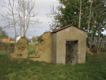
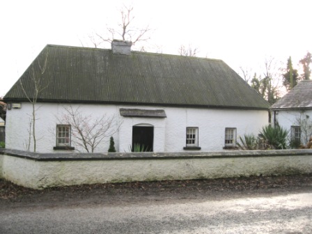
Tommy Rooney’s old house at Keenaghan, Kilmainhamwood (photo by John Corbally)Part of original front porch and crumbling walls on an old mud walled house at Gormanston near Stamullin, Co. Meath (photo by Joan Mullen)Old style mud walled farmhouse at Lionsden, Longwood. This house is whitewashed and would originally have been thatched. There is a hand pump for water in front of the house (photo by Joan Mullen)Ruins of the Grove House with large deciduous trees and contented fattening cattle at Farranalcock, Carlanstown. Paddy Harten was the last person to live in this house, he lived here until approximately 40 years ago. Before him, Phil Reilly, a herd on O’Reilly’s estate lived here. (Photo by Matthew Lynch)
Another big benefit of the field names project for family history is that for each field surveyed the surveyor or person who gathered the information is identified with name, contact address and telephone number. This can give a genealogical researcher another concrete lead if a little bit extra information about a particular townland or field is needed. The use of the database for genealogy research will really only come into its own when the full database is available through a website. Then people can browse and search through all the information that has been gathered.
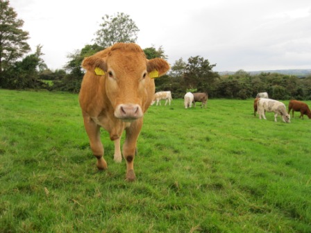
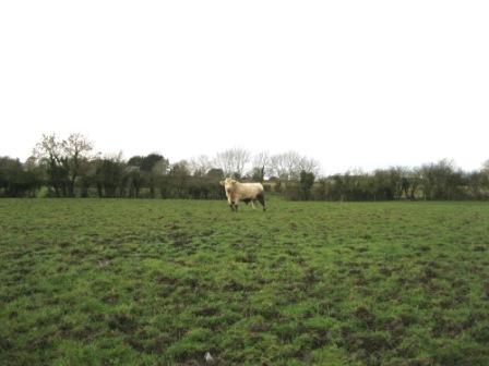
Traditionally, Meath has been known as a county with good land for fattening cattle. Younger store cattle and weanlings were often purchased in the west and south of the country and brought to Meath to be fattened and finished. An obvious question then is – what evidence is there of this tradition in the Meath Field Names Survey and the notes that accompany it?
On investigation there are numerous links in the survey to this tradition. There are about 20 fields with names like ‘Fattening Field’, ‘Fattening Park’, ‘Fattening Grass’ or ‘Fatting Field’. These were the fields with good grass suitable for fattening cattle. There are also nearly 20 ‘Bullock Fields’ or ‘Bullock Parks’. There are also references to stall feeding cattle in the winter, the Dublin cattle market and the Dublin hay market.
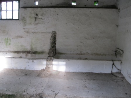
Beef cattle in Meath field (photo by Joan Mullen)Inside of old farm shed at Gormanstown near Stamullin. This shed probably would have been used for stall feeding cattle in the winter. The photo shows the manger along the wall and the chain and ring used to secure the cattle. The walls were whitewashed for disinfection purposes. The floor is sloped back and there is a channel to remove waste. (photo by Joan Mullen)
Animals and Wildlife
There is many mentions of abundant wildlife in Meath Fields and their Field Names. Wildlife mentioned includes – Whooper & Mute swans, badgers, foxes, deer, mallard, geese, pigeons, plover, rabbits, hares, eels etc
Hunting and racehorses – The prevalence and popularity of hunting in Meath is also very evident from the information and field names gathered. There are fox coverts throughout the County and several ‘Decoy Woods’. There is also the unusual feature of the ‘Hunting Gate’ which seems to be in decline. This is a narrow gate, about 3-4 ft wide that allowed the riders with the hunt to move from one farm to the next. A few notable fields have been called after successful racehorses formerly associated with the fields. There are also references to horse training and point to point racing.
This old forge made gate in south east Meath seems to have doubled as a regular field gate and a type of hunting gate. It has a regular latch but also a high latch that could be reached from horseback (photo by Joan Mullen)Hunting gate at Glenaward-Ballinlough, near Moylagh, Oldcastle (Photo by Malachy Hand)
One of the most interesting names that crops up all around the County is ‘Slang’ or ‘The Slang’. This usually refers to a strip of land, often marshy and often near a river. This name crops up all over the County, with over 200 occurences. Research indicates that this is a Hiberno English word that originated in the West of England.
T.P. Dolan’s Dictionary of Hiberno-English gives descriptions of ‘Slang’ as follows – “A narrow strip of land beside a river”, “a long narrow piece of fenced in grazing land on a farm”, “an awkward or irregularly shaped field”, “a narrow piece of land running up between other and larger divisions of ground; a long and narrow strip of ground; Hogan notes: a west of England word.”[1]. There does not appear to be any reference to ‘Slang’ in the three volumes on Irish Names of Places by P.W. Joyce.[2] A History of English Field Names by John Field[3] says that “Slang frequently signifies a narrow piece of land beside a road or sometimes a river, though it may also be found away from such features”
Slang field beside the river Boyne near Longwood. It is clear that this is a long, narrow field along a river. This is typical of many fields known as the ‘slang’ (photo by Michael Gunn)
An important finding has been a small range of particular field names that only occur in certain parts of the County. ‘The Craft’ is a field name that only seems to occur in the south of the County (Ballivor, Longwood, Enfield, Rathmolyon, Ballinabrackey and Dunboyne areas). This name is usually associated with a small field close to the yard, what might be called a ‘paddock’ in other areas. Like other names sometimes the field is just known as ‘The Craft’ while in other cases there are names like Corner Craft, Bush Craft, Doran’s Craft or Bull Craft.
This field is known as ‘The Bull Craft’ and is located at Newcastle, Enfield. It is just beside the farmyard and has a resident charolais bull (photo by Joan Mullen)
The origin of this name is not known for certain, it seems likely that it comes from the word ‘Croft’ [enclosed field or small field of unknown etymology now most familiar in Scotland].
Of course ‘The Haggard’ crops up regularly as a field name. This is almost always an area adjacent to the farm yard or what once was a farm yard. Traditionally this was an enclosed area on a farm for stacking hay, grain or other fodder. There is a range of theories on the etymology of the word ‘Haggard’. Collins English Dictionary describes Haggard as follows – “Haggard – (in Ireland and the Isle of Man) – an enclosure beside a farmhouse in which crops are stored. Related to old Norse Heygarthr, from hey hay + garthr yard.” [4] Many believe that this word may have a Scandanavian or Norse origin.
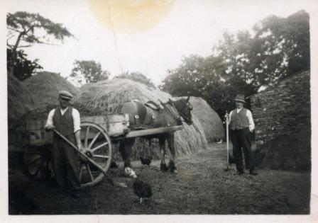
‘Hay in the Haggard’ – The Haggard was the small field where wheat, oats and barley were stacked and where the threshing took place. The Haggard was the centre of farm life activity in the autumn. This photo shows two men working in a haggard in the Ardcath area with a horse and cart and with hay ricks in the background (courtesy of Frances Lee Gargan from ‘The Parish of Ardcath Clonalvy: A History’, 2012, original photo from James McGrath)
‘Kesh’
‘Kesh’ is a field name that seems to, mainly but not exclusively, occur in the northern part of the county. It appears to indicate a stream or drain crossing or a field that had a stream crossing in years gone by. They are regularly found in areas with bog land. The project has been advised that Kesh is almost certainly from the Irish word Ceis meaning a wattled causeway or wickerwork causeway. It can be a temporary bridge made of branches over a drain or wet patch in a bog.
P.W. Joyce states: “A kish or kesh, in Irish ‘Ceis’, is a kind of causeway made of wickerwork, and sometimes of boughs of trees and brambles, across a small river, a marsh or a deep bog. The word means primarily wicker or basket work. These wickerwork bridges or kishes, were formerly very common in every part of Ireland, and are so still in some districts”[5] .
Some field names and descriptions throw up interesting language and words not used much anymore. A few incidences of – “The field Fornint / Forenth the Door” have occured, this field name refers to the field in front of the house / door. This field name has arisen in different parts of the County and is also known to be used in other Counties such as Offaly.
Mearing / Mearning / Mearn
Mearing / Mearning / Mearn are also words that crop up in field names and descriptions. Most farmers and older rural people will know the meaning of these terms but as they are not used much anymore, younger people may not know what they mean. “The field or ditch mearing separates neighbouring farms. It is the boundary ditch or fence between two farms.”[6]
[1] Terence Patrick Dolan, A Dictionary of Hiberno English, (Dublin, 1998), p. 244
[2] P.W. Joyce, Irish Names of Places,Volumes I, II & III, (Dublin, 1869-1913)
[3] John Field, A History of English Field-Names, (1993, London), p.132
[4] Collins English Dictionary , (Glasgow, 1994)
[5] P.W. Joyce, Irish Names of Places, (Dublin, 1869), p. 361
[6] Terence Patrick Dolan, A Dictionary of Hiberno English, (Dublin, 1998), p. 172