The Most Common and the Most Unusual Field Names
Meath Field Names Project has gathered approximately 24,700 field names across 850 townlands. It is now time to examine what has been found among these field names.
There are, of course, popular field names that are in many cases quite self explanatory and arise very frequently. Many fields have very straightforward, logical names. These names may refer to the location of the field on the farm relative to the farm house or yard. They often describe an important feature in the field such as a well or fort. In other cases the name of the field tells us about the type of soil in the field or the size or shape of the field.
This table shows some of the more commonly occurring field names in Meath.
|
Field Name |
Number of occurrences in Meath Field Name Survey |
| House Field | 995 |
| Hill Field | 989 |
| Bottoms | 803 |
| Well Field | 630 |
| Field with ‘Acres’ in Name | 559 |
| Front or Back Field | 550 |
| Meadow Field | 504 |
| Lawn Field | 437 |
| River Field | 247 |
| The Slang | 201 |
| Fort Field | 185 |
| Haggard | 154 |
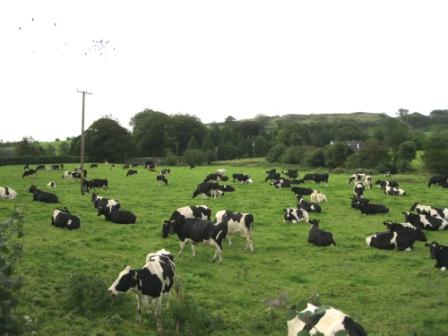
| Cow Field | 140 |
| Orchard / Orchard Field | 137 |
| Fields with ‘Horse’ in name | 104 |
| Fields with ‘Lime’ in name e.g. Lime Kiln or Lime Kill | 93 |
| Fields with ‘Black’ in name | 93 |
| Furze or Furry Fields | 70 |
| Hanging Field / Hanging Hill | 58 |
| Brick Field | 54 |
| Forge Field | 52 |
| Night Field | 42 |
| Cow Park or Cow Plot | 40 |
| School Field or School House | 40 |
| Pigeon Field | 46 |
| Railway Fields | 38 |
| Priest’s Field | 30 |
| Fields with ‘Clover’ in name | 30 |
| Pound Field | 21 |
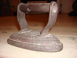
| Smoothing Iron Fields | 15 |
Two of the most popular field names are ‘The Meadow’ and ‘The Bottoms’. These names are self explanatory and are widely used all around the county. Sometimes a field might be simply referred to as ‘The Meadow’ but often the name has other descriptions included – a sample of some of these are ‘Barrack Meadow’, ‘Castle Meadow’, ‘Skane Meadow’, ‘Micko’s Meadow’, ‘Ass’s Meadow’, ‘Meadow of Tobar Anthony’ and ‘Yellow Meadow’.
‘The Bottoms’ is another field name widely used on its own, but also often with other descriptive information. ‘Flaggery Bottoms’, ‘The Lough Bottom’, ‘Christy’s Bottom’, ‘Curran’s Bottom’ & ‘The Shooting Bottom’ are just a few samples. Indeed, a field named ‘Maud’s Bottom’ raised a few smiles!
There are hundreds of Well Fields. These are fields where there were wells in the past, and in some cases still have wells in use. Wells were hugely important in rural areas and on farms before public and group water schemes came into being. As well as regular wells where people got water for everyday use, there are also many fields with Holy Wells. Very few of the fields with Holy Wells are just named ‘well field’, they tend to be named after their patron saint or their curative powers.
A great number of farms have one or more Hill Fields. These can range from fields that are just on slightly higher ground than the rest of the farm to some of the highest fields in the county with great views of the surrounding area. Most hill fields have an additional description linked to their local area and owners. A random sample of ‘Hill’ fields have names like ‘Thistle Hill’, ‘Castle Hill’, ‘Frank’s Hill’, ‘Coach Hill’, ‘Meehan’s Hill’, ‘Furry Hill’, ‘Gallows Hill’, ‘Bultrim Hill’ and ‘Fildies Hill’.
The house field is usually located beside the farm house although there are many cases where the field is still called the ‘House Field’ but all that remains are the ruins of a house. Front and Back Fields are nearly always to the front and rear of the farm house and yard.
Scores of fields have names like ‘The 10 Acre’, The ‘8 Acre’, ‘Farrelly’s Acre’ or ‘Thady’s Acre’. The actual acreage of these fields today is sometimes quite different to that indicated in the name. This happened when field amalgamations took place and, for example, one of the original fields was called the ‘8 Acre’ and the new larger field has retained that name. Some of the names like ‘Thady’s Acre’ or other single acre plots with a personal name would most likely have originally been garden plots. In some cases they are fields in their own right but in many other cases they have been integrated into bigger fields nearby with the section of the large field still known by the original name.
Many of these field names in acres refer to original measurements in ‘Irish Acres’ as opposed to statute acres. Traditionally fields were measured in Irish acres and the smaller units of rood and perch. We have about ten names of small fields that refer to ‘Rood’ measurements. These have names like ‘The 3 Rood’ or ‘The 5 Rood’. At Ongenstown the area of land known as ‘The Half Rood’, we are told, was “used by people in the old days for making mud turf. It was divided into half rood sections.” There is also one plot known as ‘The 30 Perch’ at Agheragh near Tierworker.
Lawn fields are also quite common and in many cases they are linked to larger old houses sometimes, but not always, on old Estates. River Fields can refer to fields along some of Meath’s well known large rivers such as the Boyne or Blackwater but they also often refer to much smaller rivers and streams.
At Newcastle, Enfield there is a field known as ‘Horse Park’. This field is so named because the horses that worked pulling the barge on the Royal Canal were rested and grazed here. This field name illustrates an interesting story of times past. Field names that mention horses are widespread with over 100 occurences. The most popular names are ‘Horse Field’ and ‘Horse Park’. There are also names like Horses Glen, Horse Bottoms, Horses Paddock and Horseshoe Wood. At Coolronan, Ballivor – “The ‘Horsewalk’ was a clearway for the convenience of Lord Darnley and his friends during the hunting season. Some of the natives used it as a shortcut when walking to Delvin. There was a drain on either side.” At Ballivor there is the ‘Horseshow Field’ that was used for the horse show for many years. These names reflect the past and the present. In the past many farms had workhorses and used horse and traps or horses and carts for transport.
Furry Fields and Furze Fields are usually linked to the presence of furze or whins with their familiar yellow blooms and scent in spring. Sometimes the furze bushes are still there and in other cases they have been removed. There are also a number of fields called the ‘Whinny Field’ or ‘The Whinnies’.
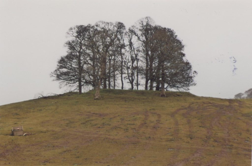
Meath still has an abundance of fields with old forts. These fields often bear names linked to the presence of the fort. There are 185 fields called ‘Fort Field’ but there are many other field names that can indicate the presence of a fort nearby. Some of these names are ‘The Lios’, ‘The Mound’, ‘Moat Field’, ‘Raheen’ and ‘Moteen’. The Meath Field Names Survey form had a specific tick box to indicate if there was a fort in the field. This has been ticked in 400 fields.
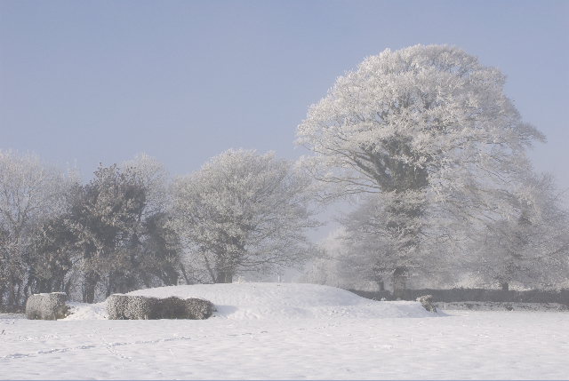
A selection of the individual fields with forts in Meath have names like ‘Lisnacrois’, ‘Hazel Fort’, ‘Sallow Fort’, ‘White’s Fort’, ‘Wake Island’, ‘Durran Hill’, ‘The Raheen’, ‘Drumherkin’, ‘Downey’s Fort’, ‘Lisnamuck Fort’, ‘Barenyarog’, ‘Lissard’, ‘The Rath Field’ and ‘The Doon’. Many of the forts have Irish names. Some old fort sites are known as ‘Fairy Forts’ and have much associated folklore. Many of the forts have trees and bushes growing on top of them. Quite a number have the familiar ring of trees. Souterrains are also mentioned at some forts. In a few cases we are told of former sites of forts where they were removed during land reclamation in the 1970s before there was a greater appreciation of these features.
Nearly 100 fields with ‘Black’ in their name were identified. They have names like ‘Black Garden’, ‘Black Hills’, ‘Black Bottom’ or ‘Black Rock’. In a lot of cases the name seems to originate from the dark soil type these fields have. There are also references to many other colours in field names like ‘Yellow Field’ and ‘Red Hills’.
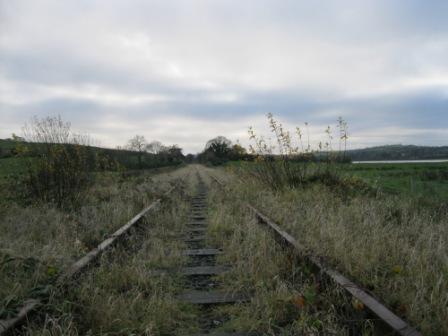
Railway Fields are almost always along used or disused railway lines. In Meath these fields mostly seem to be along disused railway lines. In some cases the tracks have been lifted and the land integrated into the field. The survey results also mention old disused railway stations and train halting spots alongside fields. Some field names like ‘Spoil Bank’ come from the time when the railways were built, and the spoil was banked up in adjacent fields. Railway stations and train travel were vital parts of everyday life for many people in the past.
In the main, ‘Night Fields’ seem to be sheltered fields near the farm yard where sheep were put when lambing or cows were put at night when close to calving. They were usually seen as safe fields and meant that the farmer did not have too far to travel to check stock at night. The term ‘Night Field’ in some cases seems to be associated with days when cattle were walked long distances by road to fairs or to meet the train. In these cases the ‘Night Field’ was where the cattle were fed and watered, and rested for the night.
Quite a number of areas have a ‘Priest’s Field’. In many cases this field is still owned by the local parish. Some of these fields were left to the local priest and parish as bequests. Others seem to link back to old Estates. Traditionally, quite a number of priests would have had cattle to graze these fields.
The fields known as ‘School Field ‘or ‘School House’ generally have, or had, a school adjacent. Field names like Slang Field, Haggard, Lime Kiln, Cow Parks / Plots and Brick Fields are discussed in greater detail in later sections.
There are over 50 fields called ‘Hanging Field’ or ‘Hanging Hill’. In the vast majority of cases these fields are so named because they are on the side of a hill or steep slope. Fortunately, the more ominous meaning of this name does not hold true in most cases although there are a number of fields mentioned throughout the county where people were hanged during 1798 and at other turbulent times in Meath’s history.
‘Clover Field’ is quite a commonly occurring name with over 30 incidences. There are names like ‘Clover Meadow’ at Balrath Demesne, Kells; ‘Clover Hill’ at Ratoath; ‘Clover Fine’ at Mullaghdillon, Slane; ‘Clover Field’ at Ballaghtalion, Trim and ‘High Clover’ at Summerstown, Trim. The field known as ‘The Clover Mór’ at Seneschalstown Cross is widely known throughout the local community. ‘Shamrock’ also crops up in some field names with names like ‘Shamrock’ at Thurstianstown, Beauparc and ‘Shamrock Hill’ at Rudder, Stamullin. The field known as ‘The Shamrock’ at Woodtown, Drumree is a lying field for the golden plover. There are ‘Trefoil’ fields at Ninch, Laytown and Drakerath, Carlanstown. We are told that the ‘Trefoil Field’ at Drakerath was one large field before being divided into several smaller fields by the Land Commission.
Quite a few fields have names related to fruit that grew in the field. There are names like ‘Damson Garden’ at Moyhill, Tierworker and ‘Damson Paddock’ at Cruicetown. The ‘Blackcurrant Field’ is at Tubride, Oldcastle. Killaconnigan near Ballivor has a ‘Raspberry Wood’ and Castlefarm, Dunboyne has ‘Plum Park’. There are many references to crab apple trees in field names all around the county. ‘Crab Ditch’ is at Newcastle, Enfield while ‘Crab Tree Field’ is at Fowlerstown near Stamullin. There are over 130 fields with ‘Orchard’ in their name. Many of these names carry a further description like ‘Old Orchard’, ‘Lower Orchard’, ‘Orchard Meadow’ or ‘Rowan’s Orchard’. In some cases the apple trees are long gone and in other cases they are still growing and producing. About ten ‘Mushroom Fields’ are also mentioned, for example there is a ‘Mushroom Field’ at Loughanstown, Rathfeigh. Wild mushrooms growing in fields are a less common sight now due to modern farming practices.
Many field names refer to current and previous field uses – names like ‘The Night Field’, ‘The Turnip Field’, ‘The Bulls Paddock’, ‘The Dairy Field’, ‘Sheep Walk’, ‘Fattening Park’, ‘The Ryegrass’, ‘Calf Paddock’, ‘Hen Run’, ‘Kitchen Field’, ‘The Drinking Hole Field’ and ‘Long Meadow’ to name just a few. More often than not the name of the field has stuck, but the modern use can be quite different to the original. The ‘Cow Field’ is probably one of the most common names in this category.
There is a range of fields with ‘Dairy’ and ‘Milk’ included in their names. These include names like “Dairy Lawn”; “Milking Banks”; “Dairy Field”; “Milk Stand Field”; “Middle Dairy” and “Milking Field”. They all reflect fields where dairy cows were kept and milked.
The survey identified over twenty ‘Pound Fields’ and these are spread all around the county. Some of these names were given with no explanatory notes. A number of the submissions had notes and some of them are detailed as follows:
“Holding field (pound) for livestock before they were moved to train station or mart” (Greenhills, Drumconrath);
“In this field there were several corners which were suitable for holding up animals for inspection.” (Halfcarton, Oldcastle);
“Originally was a public drinking place, now incorporated into adjoining field but was originally a drinking place for drovers moving cattle on boundary with county Westmeath.” (Rasillagh, Oldcastle);
“Stray animals were impounded here” (Killaconnigan, Ballivor);
“In 19th Century there was an RIC Barracks in the south east corner of this field which was used as a pound for stray animals” (Rathkenny, Slane);
“This field was presumably used for retaining animals freshly bought or being held for observation” (Newtown, Cruicetown).
Linked to their shape, triangular shaped fields often have special names. These can range from the obvious like ‘The Triangle’ and the ‘Three Cornered Field’ to ‘The Handkerchief’ and most curious of all ‘The Smoothing Iron’. The smoothing iron seems to refer to the old fashioned clothes iron and is still used as a field name quite commonly around the county. Some people also think that this name may refer to the Blacksmith’s anvil that is partially prism or triangular shaped. In some places the name has changed as it was passed down and is now said as ‘The Smooth & Iron’ or ‘The Smooth Iron’. We are told that the field name ‘Smoothing Iron’ also arises in other parts of the country including county Donegal.
Three fields with the name ‘Fair Green’ have been submitted. These are located at Skyrne, Nobber and Mulphedder, (Clonard). These fields may have hosted fairs at one time. There is also the possibility that these names come from ‘Féar’ the Irish word for grass. There are four fields called ‘Bull Ring’. These are at Ballymahon (Longwood), Clinstown (Stamullin), Ballinrink (Oldcastle) and Pigotstown (Kilallon). The name ‘Crib Field’ arises in three fields, this name refers to a small pen for putting stock in.
In all about 30% of the field names gathered fit into some of these categories for the more common field names. That is, of course, without considering any of the Irish field names or names linked to people.
It is frustrating when a field has an interesting name but nobody remains who knows the origin of the field name. Without doubt when the findings are made public and the Meath Field Names website becomes active, people will surface who can shed more light on some of these unusual field names. However, there are sure to be some field names that will remain a mystery. Details of their origin have been lost in the mists of time.
A field name really can tell a story and can suggest so much more about what the history of the field may be. These few examples illustrate this point.
For the field known as ‘Mutton Hole’ at Skryne; “Folklore says that during Famine times mutton stolen in Dunshaughlin was hidden here.” This is a very evocative name especially when the origin of this name is explained.
At Rathreynolds near Drumconrath, there is a field just known as ‘Croppy’; on checking with the surveyor, he said “there is supposed to be a Croppy Grave in the field, he thinks he knows approximately where the grave is located in the field.”
A field with an Irish name, ‘Cúl Scoil Sceach’ at Mullystaghan, Moynalty; this field name means at the back of the Hedge School. The memory of the Hedge School close to this location is being preserved in this field name.
Beesoms is the name of a field at Bryanstown close to Drogheda; we are told it is a “low lying field, beesoms grew there, used for basket making”. Beesoms are like sally rods.
At Summerhill Upper near Nobber, the field known as ‘The Horse Tom’ and the adjoining ‘Horse Tom Farmyard’ got their names from a workhorse called ‘Tom’ who worked the land here for many years.
At Shancarnan, Moynalty there is a field known as ‘The Dronuilleog’. This translates from Irish as the rectangle. There are two right angles on the laneway surrounding top of field making a rectangle shape.
‘Limbo Swamp’ is to be found at Ballynaskea near Enfield – we are told it is so called because one could disappear ‘into Limbo’, it is so wet.
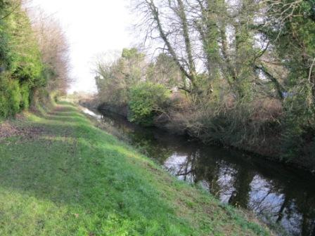
At Rataine, Robinstown there is a field known as ‘Canal Field’. Canal cuttings in fields are also mentioned in the adjacent townland of Balbradagh. We know that there is no canal in this area between Trim and Navan so this raises some questions. The Boyne Navigation between Drogheda and Navan was opened to traffic in 1800. It was then planned to extend the Boyne Navigation from Navan to Trim. Athough some work had begun on this extension, in 1803 the project was called off. Several cuttings along the proposed route from Navan to Trim survive. Some of these are located in fields at Balbradagh and Rataine near Robinstown.
The field known as Maile Dréimire or Molly Dréimire at Ughtyneill has an unusual name. Dréimire is the Irish word for ladder. On enquiry it was found that this field is on a hill and in the past steps were cut into the hill.
There was a field known as ‘Blunderbuss’ at Rathkenny. Three fields have been made into one. One of these three fields was known as The ‘Blunderbuss’. The blunderbuss was an early form of shotgun which was often adapted to military and defensive use. This weapon had a wide barrel so that it would be easier to load while on horseback. The gun could be used to fire anything from glass or nails, to stones and dirt. It was not very accurate. By the middle 19th century the blunderbuss was considered obsolete. The surveyor reports that “this is the field where the gun was buried which was used in the Rathkenny murders in 1834.”
Barney’s Field at Donore, Longwood is called after Barney McKenna, banjo player with the Dubliners. He died in April 2012 and owned this field. This is a more modern field name, but if it sticks it will have significance in years to come.
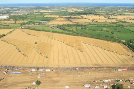
Another modern field name is ‘World Record Field’ or ‘Combines Field’ located at Platin near Duleek. It refers to the field where the Combines4Charity world record beating event took place in 2009 and again in 2012. This name is sure to stick and will carry memories of the important event that took place in this huge field for years to come.