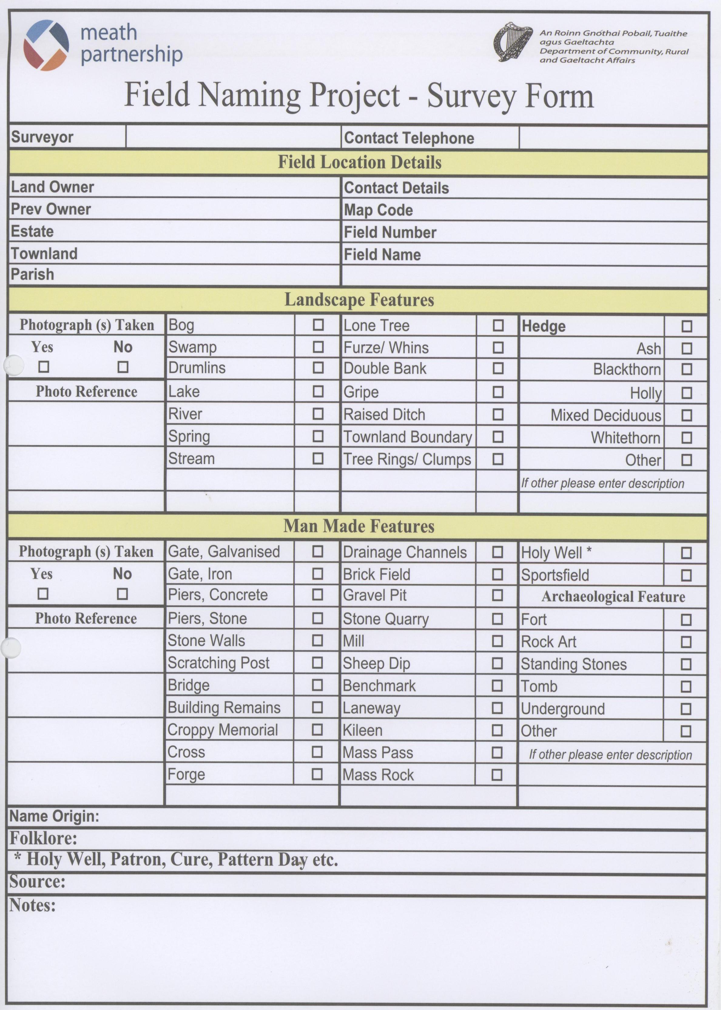
A specially designed Survey Form was devised and agreed by the project steering group at the start of the project.
This survey form recorded details about the field name, and current and previous owners. It recorded who the surveyor was which was useful if clarification was needed at a later stage. It asked if the field had ever been part of a landed estate. Critically it asked for the townland where each field is and for the field number within that townland. It also had a range of tickbox options spread between two sections, one for landscape features and the other for man made features that might be in a field.
The final section of the form left space for extra information about the origin of the field name, folklore associated with the field and general notes. This gave the surveyor some flexibility to give additional information about the field that might not have been covered by the questions on the survey sheet. Surveyors could also indicate if photographs had been taken of the field or features in the field.
At times this survey form was controversial and some volunteers felt it looked a bit long and off putting. However, it has served the project well and the extra information gathered about fields and the origins of their names has been very useful in writing up the project findings.