Penal Times

The Meath Field Names Survey form specifically asked people to tick a box if they knew there was either a Mass Pass or a Mass Rock in the field.

In the findings about 20 Mass rocks are noted and over 200 fields are identified that had a Mass pass or path. In some cases the surveyor went to the trouble of drawing in the exact route of the Mass pass on the townland map they were working on. These paper maps will be archived with all the original survey sheets at the Local Studies department in Meath County Library. It can be seen that many fields with Mass Paths also have stone stiles.

Mass Rock at Glack near Ballivor (photo by Michael Gunn)
Stone stile on Mass Path at Rushwee near Slane (photo by Joan Mullen)

There are about 13 references to Hedge Schools in the data collected through the project. Given that these Hedge Schools were so temporary in nature, it is truly amazing that so many details about them have been carried through in field lore until the present day, including the ‘Masters’ names in many cases and, in a some cases, even the fees paid by the students.


1798, Croppy Graves and Memorials

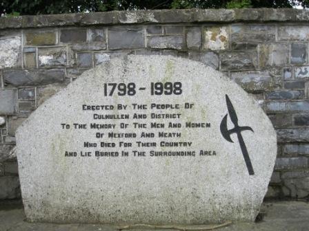
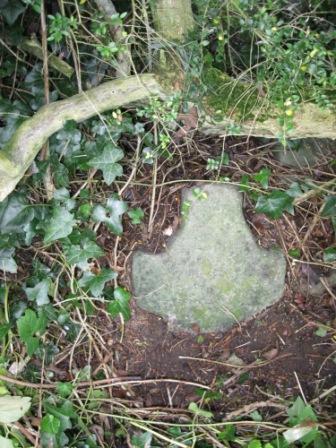
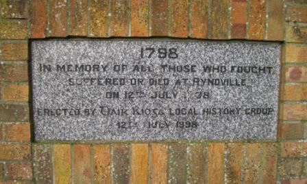
In 1798 many Wexford men died on expedition to Meath. Most of them were buried where they fell; some were only covered in shallow graves by local people. Many of the graves were marked with large stones, some of these memorials also took the form of crosses. In some cases more recent memorials have been erected on or close to Croppy graves. Often these memorials are located on the roadside adjacent to the fields where the Croppy graves are. Many of the newer memorials were erected in 1998 on the 200th Anniversary. The areas and townlands where 1798 activity and Croppy graves are referred to in the Meath Field Names Survey tie in well with the route of the Wexford Army as shown on a map in Eamon Doyle’s book, March into Meath: In the Footsteps of 1798.[1] The information regarding Ongenstown, Killallon, Moynalty and other areas west of Navan is not noted by Doyle in his publication.

1798 Memorial in Culmullen village erected in 1998 (photo by Joan Mullen)
It is thought that this small stone cross along the road at Whitewood Nobber is a Croppy memorial. There are at least three of these stones close together in the same area along the road near McDermott’s old pub (photo by Joan Mullen)
White iron cross on the roadside in Rathkenny just beside the townland boundary with Horistown as a Croppy Grave memorial (photo by Joan Mullen)
Croppy memorial erected for the 200th anniversary in 1998 at Ryndville near Enfield (photo by Joan Mullen)
Plaque on Connell’s Forge Ongenstown, Bohermeen commemorating this forge’s link to the 1798 Rebellion (photo by Joan Mullen)

Famine memories in Meath Fields

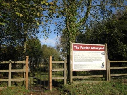
The Famine has firmly left an imprint on the landscape of Meath and on the people who inhabit it. There are almost 100 separate references to the Famine in fields surveyed through the Project.  There are many mentions of Famine ridges, somethimes also known as lazy beds.

Famine ridges, also sometimes known as lazy beds, in field at Loughcrew, Oldcastle near Cairn T carpark (photo by Seamus Smith)

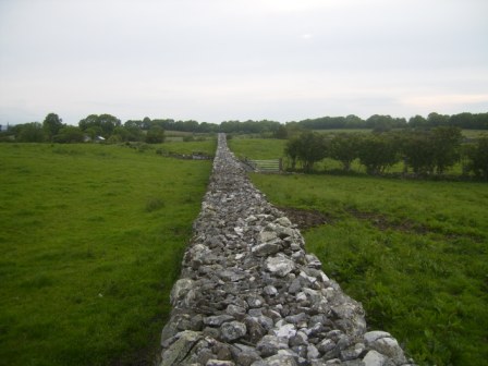
The impact of the Famine Relief work around the county is still very much in evidence. The work of road building, wall building, river straightening and even possibly the construction of a man made fox covert are all mentioned. It is poignant that several roads in the county that were built as famine relief work are still known as the ‘New Line’ today, over 150 years later.


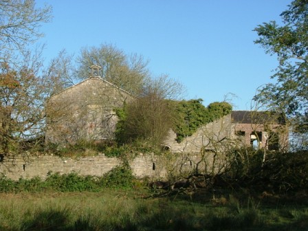
The remains of famine villages are noted in several fields. In some cases the house outlines and other features are still clearly visible. It is amazing that they have lasted untouched for so long with all the modern farming practices. Sadly, there are also many mentions of burial places in Meath fields from famine times.


There are also a few references to the Workhouse at Dunshaughlin and the Alms House at Kildalkey both closely linked to the Great Famine in Meath.

The Famine Graveyard located at the rear of the old workhouse at Dunshaughlin (photo by Joan Mullen)
Stone wall at Boolies, Oldcastle photographed from the top of the wall. This wall was built as Famine Relief work. The straightness, length and quality of the work can be clearly seen. ‘The large stone walls measure about 6 ft / 2 metres high, approximately 4ft / 1.25 metres wide and over 1 mile / 1.5 km long. These stone walls were built around 1850 (during the Famine) to give employment and clear the land. Hugh “the Bow” Reilly started the project paying each person 1d per day, working from dawn to dusk. He ended up broke having taken on such a big project.’ (photo by David Sheridan).
Iron cauldron in old farmyard near Rathkenny. These iron cauldrons are still to be found in fields and farmyards all around the County. Some of them may date from famine times (photo by Joan Mullen)
Building at Durhamstown, Bohermeen dating from Famine times. It is thought that this may have been an overflow building for the workhouse in Navan.  It thought that there are burial sites close to this building (photo by Stephen Ball)
Building at Durhamstown, Bohermeen dating from Famine times. It is thought that this may have been an overflow building for the workhouse in Navan. It thought that there are burial sites close to this building (photo by Stephen Ball)

[1] Eamon Doyle, March into Meath: In the Footsteps of 1798, (Dublin, 2011), p. 53