Sheep Passes, sheep walks and sheep gaps
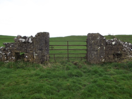
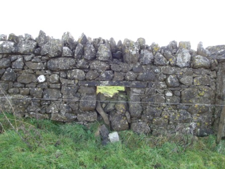
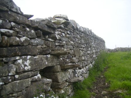
These terms all describe the same thing – an opening in a stone wall that allows sheep to pass or move from one field to another without allowing cattle through. From our survey to date, their presence in Meath seems to be limited to fields in the greater Oldcastle area.
Double ditches
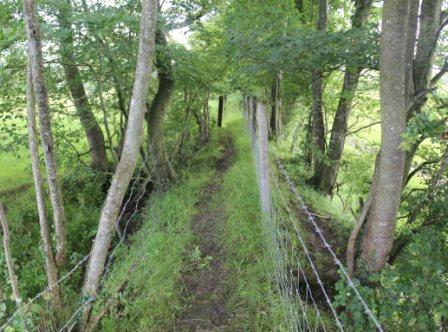
Double banks are quite common features in Meath fields, but double ditches are a much more unusual feature. A double ditch is where there are two ditches very close together with a bank in the centre. Only 30-40 fields have been identified in the survey with a double ditch. The bank up the middle is certainly wide enough for a person to walk on and in the past may have been wide enough for a person on horseback or a horse and cart. There are different theories on why a double ditch exists. Some people believe that some of the double ditches represent part of the Pale boundary. Others think they may have been part of Barony boundaries. Looking at the boundary map of the Pale it would seem possible that some of the double ditches identified were indeed part of the Pale boundary.

Benchmarks
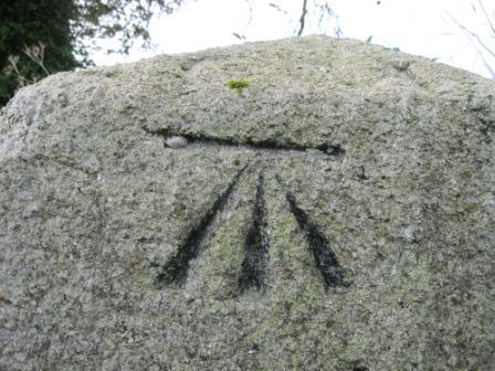
An interesting feature that has been identified in many fields around the County is what is known as a Benchmark or Sapper’s Mark. This is a cut, chiselled into stone and resembles a crow’s foot shape. They can be seen on old stone buildings, gate posts, bridges, windowsills etc. These are old Ordnance Survey indications of altitude / elevation, the name derives from the angle iron which was fitted into the horizontal cut to give a ‘bench’ or support for a leveling staff. Contouring would usually begin from a bench mark. These were put in place in the 1800’s and many have stood the test of time very well, although as older buildings and structures deteriorate they are probably a feature that is in decline.

War References
There are a significant number of references to World War I and World War II in the notes given about fields and their history. There are many references to crops grown during the Wars, mainly to wheat and flax. There are also several references to trees and woods being cut down during this time.
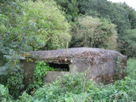
A number of fields mention the ‘Pillbox’ feature. These were small reinforced concrete buildings constructed at river crossings and at other strategic points along the Boyne. They are mentioned at the townlands of Fennor, Roughgrange and Oldbridge in returns for the Field Names Survey. There is also a prominent pillbox along the road on the south side of Stackallen Bridge (Broadbridge) across the Boyne.
The Land Commission
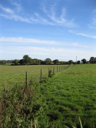
The Land Commission is mentioned hundreds of times on survey returns from the Meath Field Names Project. Expressions like ‘Land divided by the Land Commission’ or ‘This farm was a Land Commission divide’ are used. The dates mentioned for these Land Commission divisions range from the 1930s to the 1970s. The work of the Land Commission has left an indelible mark on the Meath landscape and has shaped some of the pattern of Meath fields we see today. The houses and farm yards built for migrating families were in distinctive styles and are still very evident around rural Meath today. On the fields themselves a distinctive form of fencing was often used to divide fields. This fencing has stood the test of time and can still be seen around many fields. New lanes and roadways were constructed by the Land Commission in many areas. These were frequently cul de sacs and continue to be a feature in the Meath countryside today. It is very clear from the notes that the Land Commission division of fields had a significant impact on field names. Frequently we are told of a large field on a given Estate that had a field name before division that was subsequently lost.
A Walking World
Before motorised transport people in the countryside went on foot or cycled where they needed to go. It was mainly a walking world. This was reflected in the shape and layout of the rural landscape. There were lanes, footpaths and stiles. Cross country routes that were taken as shortcuts when walking had wooden planks across ditches, drains and streams. There were many more small rural shops located much closer to each other than nowadays. This is another reflection of the ‘walking world’. The movement of cattle and sheep by foot on roads by cattle drovers was another key part of this walking world. Mass paths were used in Penal times but many continued to be used long after this time simply as the shortest route for people to walk to their local church. Country children would also have walked on shortcuts across fields to school. In the Schools Folklore Collection from the 1930s it is clear how knowledgeable the children were on the local fields and countryside. This knowledge was gained from their daily journeys to school and other places.

Killeen
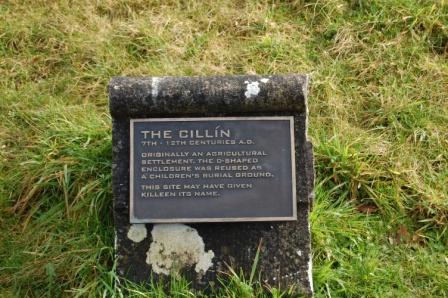
A Killeen (Cillín) is a burial place for unbaptised infants. These are sometimes located outside the walls of consecrated graveyards. There are often no stones or headstones to mark the graves and nothing visible to mark the site. In some areas Killeens were also burial sites for adults and not just infants. The presence of a Killeen in an area will usually only be known by local people and through local folklore. The Meath Field Names Project had a specific tick box on the field survey form for this feature and explained what the feature is in the volunteer helpguide booklet. The Meath Field Names survey has found at least 8 references to ‘Kileens’ among the field returns.
Sheep Bath
A feature called a ‘Sheep Bath’ or a ‘Sheep Wash’ is mentioned in several fields.
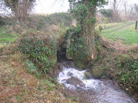
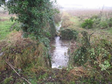
At Knockbrack (near Oldcastle) near the ‘Priest’s Wood’ we are told about a sheep bath with the following detailed description of how it worked – “There is a sheep bath located on the river in this field, also known locally as washing tub. It was used to wash sheep to clean the wool before they were shorn. The sheep bath was a man made construction built around the banks of a small river to wash the wool of the sheep before they were shorn. The construction consisted of two vertical sluice gates, one at the back to stop water entering the bath and the other 20 feet down to stop water leaving the bath. Before letting the sheep in the back gate was closed (lowered). The front gate was left open, when all the water escaped from the bath, the front gate was closed (lowered). The sheep were then escorted into the bath via a sloped side entrance. When inside the back gate was opened and raised to let the water fill the bath. Surplus water would flow over the front gate. The sheep would float about for ten minutes. The back gate would be closed and the front one partially opened allowing the water to escape and the sheep would walk out the side entrance. It works on the same principle as a lock on a canal.”
Many of these features are gone or no longer clearly visible. It would seem that many of these sheep baths or sheep washes were used to wash sheep before they were shorn so that the freshly shorn fleece would be as clean as possible. These baths were mainly constructed in rivers or streams. It was a lot of work to wash each sheep and then let the wool dry before shearing. Today sheep are not washed before shearing. The prices now paid for wool would never merit this level of effort.
Some of the references may be to the early versions of the modern type of ‘sheep dip’ where the sheep are immersed in a pit of water with additive to prevent blowfly hatching in their fleece. This is quite a different process than washing the sheep’s wool before shearing.
Victorian Cattle Underpass
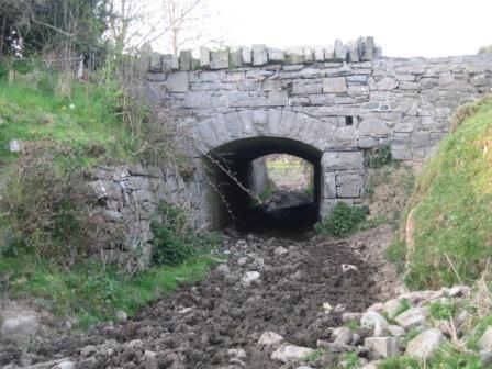
At Athgaine Great (near Cortown, Kells) there is an underpass for livestock from Victorian times, linking two fields. This was an unusual feature in those times. In modern times concrete cattle underpasses are sometimes built for farmers where their farm is split by new roads and motorways.
Other
On the project survey form there were tickboxes for other archaeological features such as Rock Art, Standing Stones, Tombs, and Souterrains. Rock art is mentioned in six townlands [Ballinvally (Oldcastle), Corrakeeran, (Kilmainhamwood), Croboy (Hill of Down), Muff (Nobber), Nevinstown (Navan), and Teltown (Donaghpatrick)].
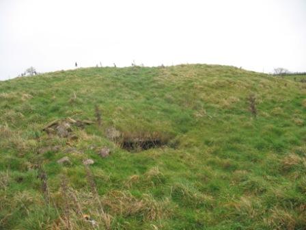
Fifty seven fields mention souterrains or underground systems; some of these fields have names like ‘Cave Hill’. Standing stones are indicated in 60 fields. Tombs are mentioned in over 30 fields.
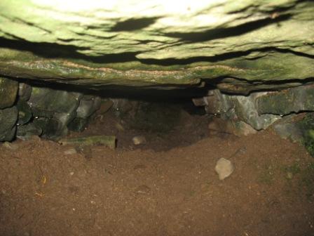
At the end of this section there was a general tickbox to indicate any other man made feature present in the field not indicated on the survey form. It was hoped that features not already known on the Archaeological Survey of Ireland would come to light. This threw up a whole range of features in fields. These included castle and church ruins, old graveyards, stone arches, síle na gig sculptures, fulacht fiadhs, coach roads, pigeon houses, dovecotes, footpaths, tumuli, dolmens, turnpike roads, old bridges and motte and bailey features. Five townlands have fields that indicate the presence of a Crannóg. They are Brittas, Whitewood and Nobber townlands all in the Nobber area, Rathkenny (Slane) and Grangend Common (Dunshaughlin).
Of course fields have been identified with many more modern features. These include features such as air strips, electricity pylons, gas pipelines, mushroom tunnels, motorways and modern horse gallops.
